Delmas (Delmas 73)
Delmas (Dèlma) is a commune in the Port-au-Prince Arrondissement, in the Ouest department of Haiti. Delmas itself is an urban continuation of the capital city. Delmas is also the location of much of the area's commercial and industrial enterprise.
Delmas is traversed by two major roadways. Autoroute de Delmas runs from Route National No. 1 in the northwest corner of the commune to Pétion-Ville on the southeast corner. Boulevard de Toussaint Louverture runs from Autoroute de Delmas to the Toussaint Louverture International Airport and beyond to the commune of Tabarre. Autoroute de Delmas is flanked on both sides by local roads. These roads are numbered, with odd numbers on the north side and even numbers on the south side. For each road, the number is preceded by "Delmas," such as Delmas 60, Delmas 19, etc. Several of these roads are significant and may have other names. Delmas 30B is more commonly known as Rue Nazon and connects Delmas to Port-au-Prince on the south. Delmas 33 connects Delmas to Tabarre on the north. The areas adjacent to Autoroute de Delmas are primarily commercial and residential. Boulevard de Toussaint Louverture leads through the industrial portion of the commune.
Subsequent to the 2003 Census, the area of Delmas commune was significantly reduced by the creation of two new communes - Cité Soleil and Tabarre - substantively carved out of the area of the former Delmas. In 2009, the residual Delmas commune had an area of 27.74 km2, and an estimated population of 359,451.
Delmas was affected by the 12 January 2010 earthquake. On 1 February 2010, electricity was restored for streetlighting in Delmas.
Lower Delmas is believed to be the stronghold of Jimmy "Barbecue" Chérizier, whose G9 Family and Allies gang controls most of Lower Delmas.
Map - Delmas (Delmas 73)
Map
Country - Haiti
 |
 |
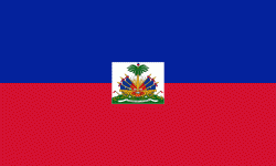
| Flag of Haiti | |
The island was originally inhabited by the indigenous Taíno people, who originated in South America. The first Europeans arrived on 5 December 1492 during the first voyage of Christopher Columbus, who initially believed he had found India or China. Columbus subsequently founded the first European settlement in the Americas, La Navidad, on what is now the northeastern coast of Haiti. The island was claimed by Spain and named La Española, forming part of the Spanish Empire until the early 17th century. However, competing claims and settlements by the French led to the western portion of the island being ceded to France in 1697, which was subsequently named Saint-Domingue. French colonists established lucrative sugarcane plantations, worked by vast numbers of slaves brought from Africa, which made the colony one of the richest in the world.
Currency / Language
| ISO | Currency | Symbol | Significant figures |
|---|---|---|---|
| HTG | Haitian gourde | G | 2 |
| USD | United States dollar | $ | 2 |
| ISO | Language |
|---|---|
| FR | French language |
| HT | Haitian Creole language |


